DIY homemade navigator products. How to make a PDA from a car navigator. What is PNA
0. Introduction
All of you have probably already encountered GPS navigators. So, before you dare to buy this device, remember: Not all GPS navigators are equally useful!
Somewhere abroad you can go to a store and buy good product. In our country, when going to the store you need to know What exactly you want to buy and how much it should cost. Otherwise they will fuck you like a sucker and rip you off like a stick.
Even now, with enviable consistency, there are people who come to Eldorado, call the seller, and say: “I need a GPS navigator.” And they leave this store with outright crap, bought for a lot of money.
For example, recently my comrades bought a sophisticated Pioneer Avic S2 behind 10,000 rubles with functions:
. Bluetooth handsfree adapter for cell phone
. MP3 player
. multimedia photo viewing
In short, all functions except one single one - navigation. Just think, what a little thing...
Because it didn’t occur to my comrades when buying a navigator to ask the seller one single question: “ Is there a map of our city there?"
Because it doesn't occur to the fucking company iGo that Russia is not only Moscow and St. Petersburg - but also a lot of different small cities, such as Lipetsk, Voronezh, Saratov, Orel and Uryupinsk, etc.
Because it doesn’t occur to the fuckers from Eldorado that there is no need to sell navigators on the Russian periphery, for which there are no maps of this very periphery, and there is no sign of it in the near future - due to the futility of this activity for a foreign developer.
1. Comparative analysis of navigation systems
Meanwhile, if my comrades were in the know, they would buy Garmin Nuvi 205 behind 8,000 rub.- for which there are maps of 63 regions of Russia, all regional centers are marked with at least street names, and half with outlines and numbering of houses.
But no, our store shelves are filled with all sorts of TomTom, Nec, Pioneer, and a bunch of noname Chinese crafts, like MIO, Orion or Shivaki. There are also completely mysterious devices with the only inscription “GPS” on the face.
Having become the proud owner of this device, people are disappointed to discover that their 500,000th city on the map is depicted as a single point at the intersection of federal highways. And more or less detailed maps are available only for Moscow, St. Petersburg, and at best a dozen large cities in Russia.
Here's a short one comparative analysis coverage of navigation maps as of 03/01/2009:
Currently, Garmin is undoubtedly in the lead in terms of map coverage, with Navitel in second place. Other navigation systems are perhaps suitable only for those who prefer not to drive their car outside the Moscow Ring Road.
3. Types of GPS navigators
If you got a Garmin navigator, rejoice: you can buy (or download;) fresh maps and drive on them.
If you have a PDA under Windows Mobile or Palm OS, or a smart phone running Symbian is also no problem: download Garmin Mobile XT, unlock, upload maps - and get a full-fledged Garmin.
But what to do if you already have a certain hardware navigator with a completely unsatisfactory software?
4. What is PNA?
Globalization and the laziness of producers provide obvious advantages. Nowadays a huge number of devices have appeared on the market P.N.A.(Personal Navigation Assistant) - based on.. Windows CE! All Pioneers, MIOs, JJ-Connects are just such devices.
A brief theory so that you understand what we are talking about. In fact, such a device is a miniature computer, with miniature Windows, controlled by a touch screen instead of a mouse. True, the manufacturer has taken all measures so that you would never guess about it: instead of a Windows screensaver, there is usually a manufacturer’s screensaver, instead of a desktop - special program, which limits the user to the device’s operating menu with its own navigation and system settings functions.
PLUS - that by bypassing the manufacturer’s shell and gaining access to Windows, we can install a bunch of necessary and original things on the device software, and generally use it as a full-fledged PDA. Craftsmen report installations of various games, book readers, video players and even office applications on car navigators.
MINUS - this is a PDA, and a PDA under Windows. A Windows, as you know, can glitch and sometimes even crash. Although WinCE is stated as operating system with increased stability - careless user actions when communicating directly with Windows can turn your pna into an unresponsive, useless device.
5. Installation files
Some smart manufacturers (eg Pioneer) they put two flash drives on the PDA - a working one and a backup one - always read-only, and make it possible to produce the so-called " cold reset" - when the contents of a working flash card with Windows and software installed are overwritten by the contents of a backup flash drive. On the one hand, this is reliable - rendering such a PDA inoperative is quite problematic. On the other hand, it is not very convenient: all the software you have installed can be destroyed with one click of the handle and replaced with the standard factory system.
Getting out of this situation is quite simple: a standard file is placed in the root of the external SD card autorunce.exe, which starts automatically after a cold reset and card detection, and installs all the necessary software from the mnavdce.cab file.
You can download a set of the most commonly used WinCE utilities from here: utils.zip. I recommend downloading and unpacking them into a separate directory on the SD card - they will be useful to us later.
7. Let's get inside
So, in front of us lies a disabled pna with a standard menu. Usually there are commands for "Navigation", "Applications" and "Settings". When you click the Navigation button, some third-party software is launched, for example:
Autosatellite on JJ-Connect"e
. Navitel Navigator on Shivaki
. iGo on Pioneer.
Thus, on a standard pna there are two shells: the first shell shows the menu, and the second one performs navigation. In this case, the WinCE desktop and taskbar are hidden. " Unlock" devices can be done in several ways, depending on the device and what exactly you want to achieve.
Option 1: replacing the navigation program with another one
. Option 2: replacing the standard menu with your own custom one
. Option 3: cancel all software shells and launch the desktop
We will consider the first option as the safest. The second and third unlocking options should be performed extremely carefully - since some devices, if an unsuccessful attempt to launch the navigation menu, are disconnected from the outside world and stop responding to events.
If you still want to unlock your pna to the PDA level, read the relevant topics on the forum. And before you do this, pay special attention to the topic " How not to kill your own navigator ".
This is especially true for those who have a navigator with only one flash drive, and the “reset” hole on the side of the device does not fully restore the OS and all installed programs- but just a regular reboot. Please note that there are MOST such models of navigators.
An awkward movement in the registry, or accidentally starting to format the system flash card from the Control Panel will lead to large hemorrhoids in attempts to revive the device.
8. Start unlocking
Remember one axiom: despite the fact that all unlocking methods are similar, there are no universal methods that would fit any device without modification. Therefore, when performing each unlocking operation, you need to understand what exactly you are doing now and what consequences it will lead to.
The first and second unlocking options usually come down to replacing the exe navigation program or start menu on the right application(detailed explanation for dummies).
First, you need to understand how the device connects to the computer. The external SD card of the device can always be inserted into the card reader, and the device itself is usually connected with a USB cord. There are two options: either it is directly seen in the system as a disk drive, or in order to exchange files with the device you will have to install Microsoft ActiveSync.
That is, we need to get Access to file system the device itself, and its external SD card. Then we empirically find (guess) where the exe file of the navigation program is located. Depending on the device manufacturer, it may be located on the memory card, or perhaps on the internal flash card of the device.
For example:
. \SDMMC\Navitel\Navitel.exe
. \SDMMC\MobileNavigator\MobileNavigato r.exe
The first thing I usually do is rename the old exe file - for example, adding the character "1" to the name: MobileNavigator1.exe. And in its place we put the already familiar one on cecmd.exe, called by the original name: MobileNavigator.exe.
Humanly, we disconnect the navigator from the computer, reboot it, wait for the menu to appear, and select the “Navigation” item. If everything is done correctly, instead of the navigation program, you will see file manager Total Commander for WinCE.
9. Examine the device
What does this give us? Firstly, you can search for information on the Internet not only by the name of the device, often unknown to Yandex and Google, but also by the system code identifier. It happens that devices sold under different brands are completely identical inside.
Secondly, now we know what OS version, processor and screen resolution we should look for software for.
Do you want to get a full-fledged PDA from your navigator? Go to the \WINDOWS folder and run explorer.exe. Then use the TaskbarShow.exe utility from the Utils.zip kit. And here in front of you is a full-fledged PDA, with a Start menu and a taskbar.
10. Getting to know Garmin Mobile XT
The further plan of action is clear: instead of the Exe-shnik, we need to attach what we need. This may be one of several programs that implement an interactive user menu. You can build into it the launch of any navigation systems, toys, and simply different programs.
In our simpler case, it should be a navigation system based on the program Garmin Mobile XT- allows you to work with Garmin maps. The main problem is that official versions of this program were released for Windows Mobile, Symbian and Palm - but not for WinCE.
If a year ago this problem was unsolvable, now craftsmen have already released several Garmin Mobile XT packages for WinCE. This became possible due to the fact that the kernels of WinCE and Windows Mobile systems are largely identical.
Here are the links to these packages:
. GarminMobXTWinCE.zip
. GarminMobileXTforWindowsCE_50010w.rar
. GarminMobileXTforWindowsCE_50020w.7z
It's difficult to say which package will suit your system. If you have version WinCE 5.00.20, I recommend starting with GarminMobileXTforWindowsCE_50020w.7z, if lower - with GarminMobileXTforWindowsCE_50010w.rar You can also find many other assemblies on the Internet, including those for unlocking specific devices.
11. Script to launch Garmin
To launch Garmin Mobile XT on WinCE it is not enough to call Que.exe. The good thing about the assemblies is that they already have a built-in script in the MortScript language to run the application. Typically this script is called Garmin.mscr and contains the following steps:
1) Check: if Garmin Mobile XT is already running, then just activate its window:
If(WndExists("Garmin Mobile XT")) Show("Garmin Mobile XT") Exit EndIf
. 2) Launch explorer.exe(if it is not already running). If your GMXT crashes with the error "Read access violation at data address 0xFFFFFFFC" - it means that most likely you do not have explorer.exe running, and Garmin needs it:
If(not ProcExists("explorer.exe")) Run("\windows\explorer.exe") Sleep(400) EndIf
. 3) Despite the fact that explorer.exe is needed for Garmin to work, task bar will only get in the way and obscure his window. To get rid of it, use the TaskbarHide.exe utility from the same Utils.zip:
Run(SystemPath("ScriptPath")\"TaskbarHide.exe") Sleep(500) Run(SystemPath("ScriptPath")\"TaskbarHide.exe")
. 4) Copy settings GMXT from the SD card to the internal flash drive of the device. If you do not save the settings on the SD card, the program will forget them every time, starting with the default settings.
XCopy(SystemPath("ScriptPath")\"Settings\*.*", "\Garmin", TRUE)
. 5) Launch Garmin Mobile XT and wait for its completion:
RunWait(SystemPath("ScriptPath")\"..\Apps\WM\que.exe")
. 6) After the application is completed, take it away settings back to SD card:
XCopy("\Garmin\*.*", SystemPath("ScriptPath")\"Settings", TRUE)
. 7) Return the taskbar to its place. Otherwise, the next time you launch explorer, it will not be visible:
Run(SystemPath("ScriptPath")\"TaskbarShow.exe")
. 8) We shoot explorer.exe- usually the navigator doesn’t need it:
If(ProcExists("explorer.exe")) Kill("explorer.exe") EndIf
This is how the script turned out. Let's launch and try. If at startup we receive the message ""ProcExist" requires toolhelp.dll" - add the library to the directory from the scripts toolhelp.dll from the Utils.zip package.
12. Unlock Garmin Mobile XT
  |
Having heard that the program will not work without a Garmin GPS receiver, we select the language and get to the main menu of the program. If you see this picture, 3/4 of your hard journey has already been completed. Go to the "Settings" -> "About System" menu and copy the memory card ID (usually consisting of 10 digits) onto a piece of paper.
 |
In line Unit ID enter the ID of the memory card. In the Software Product line, select Garmin Mobile XT. Click the top Generate button. You will get a serial number for unlocking Garmin Mobile XT for third-party (non-Garmin) GPS receivers. On the mobile device, in the Garmin folder we create text file sw.unl
We continue to work with the key generator. In line Map Product indicate. A dialog box will appear. For the set of maps "Russian Roads version 5.xx" enter FID=1280 and click OK. Click the bottom Generate button. We receive a serial number for unlocking the "Roads of Russia" maps on this device. On your mobile device, in the Garmin folder, create a text file gmapsupp.unl We write a single line into it - with the resulting serial number- at least using the Notepad editor.
If everything is done correctly, the program is unlocked.
13. Installing cards
Installing a base map of the world for Garmin Mobile XT. To do this, download the file from the official Garmin website GarminMobileXTFreeBasemap_4xxxx.exe. We start the installation, the program finds the memory card in the card reader and offers to install it there.
If your build of GMXT for WinCE did not include Garmin Mobile XT voice files (you can check their availability in the Voice folder) - download from the official website GarminMobileXTSupportFiles_4xxxx.exe. We start the installation in the same way, the program finds the memory card of our mobile device, and she herself offers to install it there.
We get a map from the Internet " Roads of Russia 5.11"It should be an .img file with a size of about 490 MB. If you have nowhere to get it, we tear out map_updater_5_11.exe from the official distribution kit, which can still be downloaded from the Garmin website completely freely. During the installation process, the program unpacks the gmapsupp.img file into a temporary directory, which You can pick it up from there - as soon as the first dialog box appears asking you to connect the updated device to the computer, I’ll immediately make a reservation that for versions 5.12 and 5.13 this option no longer works.
Extracted file gmapsupp.img version 5.11
put it in a separate folder and run the package GMapTool which can be downloaded from here:
. We add our gmapsupp.img to the list of files.
. Go to the Write tab and check the box Insert unlock code
. and enter the code from the gmapsupp.unl file into the field.
. Click write all and check that there are no errors in the logs.
. Copy the corrected gmapsupp.img to the Garmin folder on the device’s memory card.
Let's launch map_updater_5_12.exe and update the maps to version 5.12, then map_updater_5_13.exe- up to version 5.13.
The card installation process is complete. Humanly, we remove the flash drive from the card reader, insert it into the device and launch Garmin.
14. If garmin does not see the GPS receiver
On many pna devices, a situation is possible when a correctly unlocked GMXT no longer offers to register - but still stubbornly does not see the GPS receiver. This is due to the fact that the virtual COM port through which the built-in GPS receiver is connected to WinCE is already occupied by some other standard application. To get out of this situation, a program has been created Port Splitter, which was mentioned earlier.
It is designed to “share” one COM port on which the GPS receiver operates between several applications - by broadcasting data from it to virtual COM ports: COM1..COM9. The Port Splitter.exe file must be placed in the same folder where the script for launching GMXT - garmin.mscr is located.
There are two options for the Port Splitter program:
. up to version 1.20 inclusive, the program stores its settings in the registry
. version 1.30 saves the settings in the settings.dat file (which for some reason is always dated 01/01/2007)
 |
Add to the list of outgoing ports at least one port to which we will distribute signals from the device. Let's say it will be COM0. Be sure to check the "Autorun" checkbox. Click "Start", then "OK" in the window title. The window should disappear.
We launch GMXT and make sure that the GPS receiver is found. If you are indoors, do not expect satellites to be found. But the program must recognize the receiver and begin the process of searching for satellites.
Run Port Splitter.exe again. Click "Stop", then "Exit". We look carefully at the directory where the program was located - a file should appear there Settings.dat. Copy it under the name Settings.bak. This is done so that if for some reason the port splitter settings are lost, the next time you start it, you can restore them from the backup file.
In order to automate this process, add the following lines to garmin.mscr between 3) and 4) points:
Copy(SystemPath("ScriptPath")\"Settings.bak", SystemPath("ScriptPath")\"Settings.dat", TRUE) If(not ProcExists("Port Splitter.exe")) Run(SystemPath("ScriptPath" )\"Port Splitter.exe") Sleep(500) EndIf
15. Finishing touches
 |
To do this, go to the “Where” menu -> “Address” -> Lipetsk (or any other regional center), Lenin St., 1. After the program has found our house, or at least suggested houses with similar numbers, we press the “On the map” button. We get as close as possible and make sure that the outlines of the houses are visible.
Now we need to make sure that the “Navigation” button launches not cecmd.exe, but GMXT. Let's use the package runme.zip, consisting of three files:
. runme.mscr - a custom script in the MortScript language
. MortScript.exe - MortScript language interpreter
. runme.exe is a program whose only task is to run a script whose name matches the name of the .exe file.
We are looking for the name and location of the exe file that is responsible for the navigation system (we replaced it in section 8). For example, if it is called Navitel.exe and is located in the Navitel folder of the SD card, we rename runme.exe and runme.mscr to Navitel.exe and Navitel.mscr, respectively, and put them in the same folder on the card.
Editing Navitel.mscr:
Errorlevel("warn") RunWait(SystemPath("ScriptPath")\"..\Garmin\RunGMXT\Garmin.mscr")
We put the flash drive back into the device, reboot it, and try it: when you press the “Navigation” button, GMXT should start.
16. Conclusion
Did not work out? We carefully carry out everything step by step from the beginning. We smoke the forum until we feel completely enlightened. The author has already installed GMXT on Pioneer, on Voxtel and on Shivaki - and declares with full responsibility: there are NO universal unlocking methods that would fit every device without a single change!
Happened? We say Thank you to the author :)
As an example, a package for unlocking the Shivaki navigator (of course, without maps) can be downloaded (43 MB).
I'm looking forward to finally being able to install the Garmin Mobile XT on my vacuum cleaner and connect my microwave to the "live log"...
Many modern phones have GPS, but for the navigator to work, you need to download maps via the Internet, which is a problem far from GSM towers. Another big problem is the rapid drainage of smartphone batteries, especially in the cold season. At one time, the traveler is left not only without navigation, but also without communication. Having an independent navigation device with you will be very useful. A similar device will be proposed in the article below.
Target of this device is to indicate in which direction to move and show the remaining distance to the point to which you need to arrive. Before leaving, the traveler needs to save the control point to which he wants to return. After this, the arrow will point to the departure location and the distance will be indicated in numbers. Of course, it is necessary that the satellites are “caught” and the coordinates of the current location are determined.
Homemade navigator diagram

The circuit is based on an ATMega64 microcontroller clocked from an external quartz resonator at 11.0592 MHz. NEO-6M from U-blox is responsible for working with GPS; although it is old, it is a very common and inexpensive module with fairly accurate determination of coordinates. Information is displayed on the display of Nokia 3310 (5110). Also present in the diagram magnetometer HMC5883L and accelerometer ADXL335.

HMC5883L A fairly common and inexpensive sensor, a standard I 2 C interface is used to communicate with the microcontroller.
The chip is available in a tiny 16-pin LPCC package measuring 3x3 mm.
Pin designation:
- SCL - I2C bus clock input
- VDD - input for connecting power (this booger is fed with a voltage in the range of 2.16-3.6 volts)
- not used
- S1 - additional power supply for I/O ports. Connects directly to VDDIO pin
- not used
- not used
- not used
- SETP - first input for connecting a 0.22uF ceramic capacitor
- GND - ground
- C1 is another input for connecting a capacitor. Electrolytic or tantalum at 4.7uF (the other end of the capacitor is connected to ground)
- GND - ground
- SETC - second input for connecting a 0.22uF ceramic capacitor
- VDDIO - input for connecting voltage that will be on the input/output ports
- not used
- Interrupt output, when the data is ready, logic 1 appears on this pin
- SDA - I2C interface data line
Navigator circuit board

The circuit and board are designed in the EasyEDA system.


The device is turned on and off by long pressing the S5 button. After turning on and searching for satellites (during a cold start it can take up to 10 minutes or even more), we can view the current coordinates by pressing the S2 button.

The coordinates of the end point can be viewed by pressing the S3 button.

By pressing the S4 button we get to the point saving menu. There are two ways to save a point:
- save current coordinates


2. enter coordinates manually


Enter degrees, minutes and seconds one by one. The selected value to edit blinks.
You can return to the mode of following the point by short pressing the S5 button

Now about using the magnetometer and accelerometer. To calculate azimuth, data obtained from GPS receiver, therefore, if it is not possible to calculate the coordinates (for example, if the satellites are not visible or there are few of them), it is impossible to calculate the direction in which you need to move in order to arrive at the point. And my original idea was to use the magnetometer as an aid to indicate the course. But I encountered some difficulties.
Firstly. Those who are familiar with the operation of digital magnetometers know that the accuracy of their data depends on the position in which they are located. Therefore, for correct operation in any position, it is necessary to use an accelerometer, which would give a more accurate picture of the projection of the magnetic field on all three axes of the magnetometer. Possible Solution I saw this problem in a magazine. but I have not yet managed to transfer the entire calculation to Bascom (maybe one of the enthusiasts will do it?).
Secondly, the difference in magnetic declination in different parts of the Earth has a noticeable effect. For example, in the Volga region the magnetic declination is 13°, and at the other end of the country the declination is already 11° and in the other direction. But there is also magnetic inclination - when the magnetic field lines enter or exit at an angle to the horizon, and many other factors that influence the readings.
Of course, you can use such non-calibrated data from a magnetometer to roughly indicate the direction, but for now I decided to abandon this idea and made a simple compass, which can also be useful. The compass is turned on by pressing the S1 button. And in order for it to point more or less correctly to the north (more precisely to the north magnetic pole), the device must be held horizontally. To help with this, two lines run along the sides of the screen, which show the tilt in one direction or another.
All that remains is to print a housing for the device on a 3-D printer, but for now let’s talk about the results of street tests. The device turned out to be very interesting and quite helpful in getting to the saved point. But you need to understand that you should not expect millimeter accuracy. An error in determining GPS coordinates of just one second will result in an inaccuracy in determining the position of 20 meters. Also, errors inevitably accumulate when rounding in mathematical calculations. But nevertheless, the device, even in dense urban conditions, made it possible to return to the point with an accuracy of several meters.

This device will become an indispensable assistant for those who like to wander through the forest, mushroom pickers, skiers, tourists and other nature lovers!
Components used in the device (they can be ordered from an online store from China):
- GPS module NEO-6M
- LCD display
- Magnetometer HMC5883
- Accelerometer ADXL335
Guide housing


P.S. At the request of users, I updated the firmware (there are two firmwares in the link above), excluding the accelerometer and magnetometer from the circuit. Now, by pressing the S1 button, information about the battery voltage, UTC time and date, as well as azimuth will be displayed - the same compass :)
I wanted to use GPS for all sorts of electronic crafts. I reviewed a bunch of options and finally formulated my wishes:
Lowest price possible
- dust and moisture protection - so that you can screw it into a car, for example
- no non-standard chips - only the filling for which there is a lot of documentation
- no USB - only hardcore serial connection so that you can use it in simple crafts.
And it worked!
When you just start looking for a suitable piece of hardware for Arduino or some other microcontroller, something like this quickly catches your eye:
Pay thirty, forty, fifty dollars, the GPS is soldered in - and if you are going to hide the craft, for example, under the hood of a car, be so kind as to buy a GPS antenna and an adapter for it for additional money. At this point the amphibian shakes its head negatively:(
Another option is GPS receivers for a computer with a USB cable, they are cheaper. If you choose this option, you will have to pay $20 for a USB shield and hope that you will be able to find a decryption of the protocol for a specific Chinese-made product. Well, or connect an old unnecessary Android smartphone via USB-shield, but then goodbye turn-on speed and hello to a sea of problems - with the battery, turn-on, brakes, etc.
And then I find this on DX:
The device was made not even in China, but in Taiwan by a company specializing in GPS, and this model- designed for use on boats, has moisture protection and even a built-in magnet for attaching to the roof and a suction cup for installing on glass. Inside is the de facto standard - the SiRF Star III chip. And the price tag for this miracle is just under $35!
The unit has 2 variations - with USB and with a serial port (model), I make sure that I take the second one and order it. While the Russian Post is slowly dragging the parcel, I delve into the documentation.
All “serial” peripherals have 2 implementations - “RS-232” and “TTL”. The first one was used more than ten years ago for modems and mice - it uses a current from minus N volts to +N. In modern microcontrollers, incl. Arduino, the second one is used - where when transmitting data, “ones” are indicated by a current of +5 volts (or 3.3 volts), and “zeroes” are indicated by the absence of current. After reading the cries of “oh, I plugged it into the Arduino, but it doesn’t work!” I realized that I also needed a TTL/RS-232 converter. At first I looked for the “MAX3232” chip usually used for these purposes, and then for a couple of cents more I found it already soldered, with connectors:
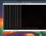
We launch it, and we see that the unit on the windowsill caught 11 satellites and determined the coordinates with an error of several meters:

As you can see, no additional power was required - the current from a regular 0.5A USB port is sufficient - i.e. and the microcontroller will handle it. Moreover, everything works through a one and a half meter cable of the GPS receiver itself and a three meter extension cord. More than enough to stuff a microcontroller inside a car, and place a GPS, for example, above the top edge windshield.
The speeds fully correspond to those stated in - “cold start” - less than a minute, “hot” - a second.
In total, for about forty bucks I got a kit that turns any Arduino craft into a more interesting thing. Personally, I will use it to make a GPS tracker for a car with GSM, connection to the on-board computer via OBD-II and other small joys.
Additions requested by commenters:
Russian-language instructions: Half the pages describe connecting to a PDA with Windows Mobile, however.
Link in large letters - (pdf). Weight - 62 grams, current consumption - 80mA, protocol - NMEA 0183 or binary. Cold start- 42 sec., warm - 38 sec., hot - 1 sec. The refresh rate with the settings “out of the box” is 1Hz, however, the specification includes “reacquisition - 0.1 sec”.
I'm planning to buy +50 Add to favorites I liked the review +47 +89A wide range of GPS devices of different price categories are available in specialized stores. Powerful models with advanced functionality are quite expensive, while the simplest beacons are affordable. However, many people try to avoid the expense and make their own GPS tracker. How difficult is this task, what will be needed to solve it, and will the effort be worth it?
Using a Smartphone for GPS Tracking
To use a GPS-enabled smartphone as a GPS tracker or beacon, you need to do a little tinkering with the software. Make your own GPS tracker from your phone on Android based, Windows Mobile or iOS is very simple, no intervention in its design is required. If the smartphone is used as a car tracker, you will have to perform simple manipulations to connect it to the vehicle’s electrical network.
There are several applications that allow you to turn your smartphone into a tracker. For Android devices, you can download it from: Google Play Loki application, launch it on your smartphone and configure the settings. It is recommended to activate the following functions:
- autostart;
- notifications (optional);
- external power (using alternative settings when connecting to external source nutrition);
- full awakening (optional);
- command processing.
For navigation (location determination), it is recommended to set the data update interval once a minute; for sending SMS messages when communication with the server disappears, the time limit is 5 minutes. Make settings in the “Events” section in accordance with your own needs.
After completing the settings, all that remains is to register on the Asgard website and add your device, indicating the identifier defined by the Loki program. If, as a result, a mark of your location appears on the site map, then everything was done correctly, and the smartphone can be used as a tracker, tracking its location through Asgard.
You can also use the GPShome Tracker application for Android, and GpsGate Client for Pocket PC for Windows Mobile. When turning a smartphone into a tracker or beacon, it is extremely important to set the time zone correctly.
To determine coordinates through Wi-Fi networks and GSM, the device must have access to unlimited mobile internet, so you need to choose a tariff that allows you to optimize costs. If the phone will be used exclusively as a tracker, it is better to install a SIM card only for accessing the Internet, and not for calls. Using a GPS receiver, which increases the accuracy of determining coordinates, is a very energy-intensive process, so care should be taken to provide power to the homemade tracker. To do this, you need to cut off the lower end of the car plug (cigarette lighter plug) and insert the phone charger cord into the USB connector. To connect the tracker directly to the on-board system you need to buy a step-down converter direct current. And those who know a little about electronics can assemble an analog converter from a pair of capacitors and a stabilizer.
If a homemade tracker (beacon) is planned to be used for hidden tracking When moving a car, you need to think about where to hide it so that if necessary, you can easily get it. And don’t forget to activate silent mode if your phone has a card installed for the Internet and calls.
How to make a GPS tracker with your own hands from a regular phone
The simplest model mobile phone Without GPS, you can also turn it into a beacon, but this will require additional equipment and more effort. Required materials and tools:
- mobile phone;
- GPS/GPRS module;
- GPS receiver;
- adapter (you can use an old Charger with working plug);
- knife and soldering iron.
Having cut off the charger from the side of the power supply, you need to strip the wires and solder them to the module board, and insert the plug into the phone's power connector. Then the receiver is turned on and the phone is set up. Using such a device, you can track the location of mobile phones belonging to your family members. Information about their coordinates will be sent to a mobile phone combined with a GPS module in the form of regular text messages.
Some operators cellular communications offer the “Beacon” service, which can be activated on any mobile phone without a GPS module. A list of contacts of subscribers whose location needs to be tracked is compiled. To receive a message with coordinates, you need to send a request in the prescribed form.
Is it possible to make a GPS tracker without a phone?
There is an alternative to using a smartphone or telephone in combination with a GPS module - any device with GPS function (laptop, PDA). The principle is the same as for a smartphone - install the application, settings, register the device on the website.
Is it possible to assemble with your own hands the GPS module and receiver that make up the beacon or tracker? Here are some of the components included in these devices:
- photoresistor, usually short-wave;
- operational amplifier based on bipolar transistors;
- rectifier;
- capacitor type controller;
- mesh filters;
- impulse trigger.
All these parts can be bought, and the device diagram can be found on the Internet, but not everyone can figure out how to make a GPS tracker with their own hands.

Advantages and disadvantages of a homemade design
If you are using an old and unnecessary phone (smartphone), then the main advantage of converting it into a tracker is savings. If you purchase a device specifically for this purpose, the savings from making a GPS tracker yourself are almost imperceptible. The design of a mobile phone and a GPS module is quite cumbersome, it is inconvenient for a person to carry it with them, and when installed in a car there is a high risk of wire breakage. It is more convenient to use a smartphone as a tracker or beacon, but only for tracking people. Installing it on a car is not the best solution; the original tracker has a number of advantages over a homemade one:
- runs on battery for up to a year;
- without any tricks it connects to the on-board network, consuming a minimum of energy;
- designed for operation in a wider temperature range than a telephone;
- thanks to the sealed housing, it can be installed outside the car;
- reacts to impacts, rocking of the car;
- can be equipped with a panic button, microphone, and various sensors.
If you use a smartphone as a hidden tracking device, it will no longer be able to perform the functions of a communicator.
It is better to buy a GPS tracker or beacon than to use a homemade device based on a smartphone or regular mobile phone. The factory tracker is more reliable and easier to install on vehicle, performs more features. The cost of purchasing a tracker is not that high, and turning a smartphone into a tracking device is justified only if you have an unnecessary device.
I think for most of you it will not be a discovery that the vast majority of modern car navigators work on the basis of Windows CE, but the operating system itself is carefully hidden by the manufacturer from the user’s playful hands, so that he does not do anything unnecessary.
This was done by a simple but radical method - replacing the native graphical shell of Windows CE with a shell from the device manufacturer, which starts when Windows startup. On the one hand, this is good - a convenient menu, the main functions are launched in 1-2 clicks, babble in one word. But on the other hand, the user is limited only by the functionality that the manufacturer decided to provide; there is no opportunity to install their own programs. However, it is very simple to establish the triumph of justice; you only need a GPS navigator, a data cable, a computer that can work with Win CE devices in Active Sync mode and a couple of minutes of free time.
Attention! This instruction is not universal, but helps in most cases. Deviation from steps and creative experimentation can leave your navigator in an inoperable state, which can only be cured by flashing it. If you have no idea why you should do this, don’t do it, because it doesn’t matter!
So, as Gagarin said: “Let's go!”:
If something is not clear, then here is a picture where everything you need is highlighted:

The main thing is not to touch anything else, otherwise the chance of getting a half-dead piece of iron is very high.
As a result of performing these simple steps, you will get a fully functional PDA from the navigator on which you can easily install any applications you need. It's a small thing, but nice.
Z.Y. In no case! Do you hear? Under no circumstances! Even if you are completely drunk, stoned, or high (underline as appropriate), do not set a password on Windows. Including in order to see what happens!
A fully functional PDA will come in handy even if you are learning the basics of SLR photography; you can always write down a few instructions and tips for amateur photographers on it so that they are always at hand.