Geographic information systems software. Software and technologies of geographic information systems: Tutorial Application software for GIS
Ministry of General and Vocational Education Russian Federation Krasnoyarsk State University Research Department of Biophysics Institute of Computational Modeling SB RAS Krasnoyarsk Interuniversity Center for Information Technologies in Environmental Education S.S. Zamai, O.E. Yakubailik SOFTWARE AND TECHNOLOGY OF GEOINFORMATION SYSTEMS TRAINING MANUAL Krasnoyarsk 1998 UDC BBK S.S. Zamai, O.E. Yakubailik. Geo software and technology information systems: Textbook. allowance / Krasnoyarsk. state univ. Krasnoyarsk, 1998. 110 p. Tutorial is dedicated to software and technologies of geographic information systems (GIS). The areas of application of GIS and their issues are considered. practical use for solving various applied problems. The review of technologies for entering and processing spatial information outlines the general principles and requirements for GIS software data sets and analyzes common exchange formats for spatial data. An assessment of the end-user GIS and software development tools is given. Using the example of the GeoConstructor™ class library, the main problems that arise when creating GIS applications are identified. Methods for constructing multi-user geographic information systems are considered. The textbook was prepared as part of the work on the Federal Target Program “Integration” No. 162 and was tested in classes with students as part of the activities of the Interuniversity GIS Center, supported by the Federal Target Program “Integration” project No. 68. Fig. 21, tab. 1, bib. 20 titles Reviewers: Doctor of Physical and Mathematical Sciences, Professor A.N. Gorban, head lab. Institute of Computational Modeling SB RAS; Ph.D., Professor G.M. Rudakova, head department information technologies SibSTU Editor O.F. Alexandrova Proofreader T.E. Bystrigina © S.S. Zamai, 1998 ISBN O.E. Yakubailik, 1998 2 Contents PREFACE 6 1. FIRST ACQUISITION WITH GIS 8 1.1. What is GIS? 8 1.2. Areas of application of GIS 10 Local administrations 10 Utilities 10 Environmental protection 11 Healthcare 12 Transport 13 Retail trade 13 Financial services 14 1.3. How it's done... 14 1.4. GIS Software Trends 16 1.5. What is what 17 1.6. How is it structured? 18 2. SOURCES OF INITIAL DATA AND THEIR TYPES 19 2.1. General geographical maps 20 2.2. Nature maps 21 2.3. Population maps 23 2.4. Economic maps 24 2.5. Maps of science, personnel training, public services 26 2.6. Political, administrative and historical maps, comprehensive atlases 27 2.7. Remote sensing materials 28 3 3. TECHNOLOGIES FOR INPUT AND PROCESSING OF SPATIAL INFORMATION 29 3.1. Collection and systematization of data 29 3.2. Data preparation and transformation 31 3.3. Processing and analysis of data during GIS operation 35 3.4. Description of GIS exchange formats 38 VEC (GIS IDRISI) 38 MOSS (Map Overlay and Statistic System) 38 GEN (ARC/INFO GENERATE FORMAT - GIS ARCI/NFO) 40 MIF (MapInfo Interchange Format - GIS MAPINFO) 41 4. SOLVING PROBLEMS IN GIS END USER 45 4.1. Classification of GIS software 45 4.2. Evaluation of GIS tools 47 Support for spatial data models 47 Spatial analysis functions 48 Spatial information input/output tools 51 Format conversion tools 51 5. GIS APPLICATION DEVELOPMENT TOOLS: GEOCONSTRUCTOR™ 52 5.1. GeoConstructor™ as a tool for creating GIS applications 53 5.2. Implementation of GeoConstructor in the development environment 54 5.3. Creating cartographic compositions 57 5.4. Managing a set of layers and a map image 59 5.5. Working with objects: navigation, search, selection 62 5.6. Linking external databases 65 5.7. Thematic mapping 66 5.8. Error handling and mouse control 67 4 5.9. Class gisMap 69 6. REVIEW OF SOME GIS 70 6.1. ESRI software products 70 ARC/INFO system extension modules 74 6.2. GeoGraph/GeoDraw for Windows 78 GeoGraph for Windows 78 GeoDraw for Windows 81 6.3. Panorama software 83 Purpose of the program 83 Software structure 85 Software capabilities 86 Vector map 88 7. METHODS OF BUILDING MULTI-USER GEOINFORMATION SYSTEMS 92 7. 1. Local GIS 95 7.2. Several users share one set of files with geoinformation 96 7.3. Geographic information systems with a large number of users 97 7.4. Internet/intranet technologies 99 CONCLUSION 105 TEST QUESTIONS 107 LITERATURE 108 5 Preface This tutorial provides an overview of software and technologies of geographic information systems (GIS). The areas of application of GIS and issues of their practical use for solving various applied problems are considered. The review of technologies for entering and processing spatial information presents general principles and requirements for data sets used in GIS software. Particular attention is paid to exchange formats of spatial data, detailed descriptions which will allow you to use this publication as a reference book. The section on end-user GIS discusses the main categories of this software and evaluates the tools. Methods for constructing GIS applications are considered in detail - using the example of the GeoConstructor™ tool library (developed by the Central Geographic Institute of the Institute of Geography of the Russian Academy of Sciences), as well as issues of integrating GIS with database systems. The technologies described in the manual are used by the authors in the project activities of student teams aimed at creating models of knowledge-intensive information systems to solve territorially oriented problems. The activity is organized within the framework of the Interuniversity Center for Information Technologies in Environmental Education, its results are used in the implementation of regional programs and informatization projects. The software was supplied with the assistance of the GIS Association of Russia by the companies TsGI IG RAS (GeoDraw/ GeoGraph), GeoSpectrum International (Panorama), Epsylon Technologies (Baikonur). The Interuniversity Center for Information Technologies was established by several universities in Krasnoyarsk: State University (KSU), Technical University (KSTU), Technological University (Siberian State Technical University), Pedagogical University (KSPU). Its activities are financially supported by the Krasnoyarsk regional and city environmental funds, a grant from the Federal Target Program Integration No. 68. The center is based at the Institute of Computational Modeling of the SB RAS in Akademgorodok. The source materials for this manual were articles and abstracts from a number of conferences organized by the GIS Association of Russia, press releases and official materials from manufacturers and suppliers of GIS software, as well as a considerable number of journal articles and monographs. We express our sincere gratitude to all the authors of the mentioned materials. The authors can be contacted by e-mail – [email protected]. 7 1. First acquaintance with GIS “Ten years ago, when everything was just beginning, it seemed: here on the monitor screen we see maps and can put various symbols, for example, the content of harmful substances. It turned out to be very visual and simple picture , and all the “spectators”, from public policy to municipal government, and even scientists, were thrilled with pleasure, looking at the contents of the screen. But everything has its limit, and now there has already been a saturation with such things.” From materials of the GIS Association. 1.1. What is GIS? The semantic and substantive interpretation of the term geographic information systems, or GIS, strongly depends on the professional interests of the person giving the definition. If you listen to some people, you might think that the only way to solve your organization's problems, as well as the world's problems, is with the help of GIS. Of course, GIS is applicable to a very large number of applications in various subject areas, and with its help many problems can be solved faster and more efficiently. But you should always remember that GIS is only a set of excellent tools, used in different ways by specialists to solve them. Therefore, it is important to understand how you can increase the efficiency of an organization using GIS. It is very difficult to define GIS precisely because it can be viewed at multiple levels when operated and will mean different things for different applications. For some, GIS is a set of software tools used to enter, store, manipulate, analyze and display geographic information (Fig. 1). This is a technical definition that reflects the history of the development of GIS as a combination of computer-aided design (CAD) tools with digital cartography and database programs (DBMS). For others, GIS may be a way of thinking, a way of making decisions in an organization where all information is related to space and stored centrally. This is more of a strategic definition. It is important to understand that GIS may not be the solution to your problems and will require some thought to successfully complete the tasks. GIS is a system consisting of three components, each of which is necessary for success: spatial data, hardware and software tools, and the problem as an object of solution. Moreover, the problem serves as the main component that forces one to choose methods of transmission. 1. Map of Krasnoyarsk in the GeoGraph program for Windows. Created at the GIS Technology Center, Institute of Computer Science SB RAS 9, data storage, data analysis, and software tools, and technologies for creating one or another subject-oriented information system. 1.2. Areas of application of GIS Local administrations Municipal management tasks are one of the largest areas of GIS applications. In any area of activity of local administration (land survey, land use management, replacement of existing paper records, resource management, accounting of property (real estate) and highways) GIS is applicable. They can also be used at command posts of monitoring centers and in first responders. GIS is an integral component (instrumental, technological, software) of any municipal or regional management information system. Utilities Utility organizations most actively use GIS to build a database of assets (pipelines, cables, pumps, distribution stations, etc.) that is a central part of their information technology strategy. Typically, this sector is dominated by GIS, which provides modeling of network behavior in response to various deviations from the norm. Automation systems for mapping and management of fixed assets are most widely used to support “external planning” in an organization: laying cables, positioning valves, service panels, etc. (Fig. 2). 10
GIS software is divided into five main classes used. The first most functionally complete class of software is instrumental GIS. They can be designed for a wide variety of tasks: for organizing the input of information (both cartographic and attribute), its storage (including distributed, supporting network work), processing complex information requests, solving spatial analytical tasks(corridors, environments, network tasks, etc.), construction of derivative maps and diagrams (overlay operations) and, finally, to prepare for the output of original layouts of cartographic and schematic products on hard media. As a rule, instrumental GIS support working with both raster and vector images, have a built-in database for digital basis and attribute information, or support one of the common databases for storing attribute information: Paradox, Access, Oracle, etc. The most developed products have run time systems that allow you to optimize the necessary functionality for a specific task and reduce the cost of replication of help systems created with their help. The second important class is the so-called GIS viewers, that is, software products that provide the use of databases created using instrumental GIS. As a rule, GIS viewers provide the user (if at all) with extremely limited options for replenishing databases. All GIS viewers include tools for querying databases that perform operations of positioning and zooming of cartographic images. Naturally, viewers are always an integral part of medium and large projects, allowing you to save costs on creating some jobs that are not endowed with the rights to replenish the database. The third class is reference cartographic systems (RSS). They combine storage and most possible types visualizations of spatially distributed information contain query mechanisms for cartographic and attribute information, but at the same time significantly limit the user’s ability to supplement the built-in databases. Their updating (updating) is cyclical and is usually carried out by the SCS supplier for an additional fee. The fourth class of software is spatial modeling tools. Their task is to model the spatial distribution of various parameters (relief, zones of environmental pollution, areas of flooding during the construction of dams, and others). They rely on tools for working with matrix data and are equipped with advanced visualization tools. It is typical to have tools that allow you to carry out a wide variety of calculations on spatial data (addition, multiplication, calculation of derivatives and other operations).
The fifth grade that is worth focusing on is special means processing and decoding of earth sounding data. This includes image processing packages, equipped, depending on the price, with various mathematical tools that allow operations with scanned or digitally recorded images of the earth's surface. This is a fairly wide range of operations, starting with all types of corrections (optical, geometric) through georeferencing of images up to the processing of stereo pairs with the output of the result in the form of an updated topoplan. In addition to the mentioned classes, there are also various software tools that manipulate spatial information. These are products such as tools for processing field geodetic observations (packages that provide interaction with GPS receivers, electronic tachometers, levels and other automated geodetic equipment), navigation tools and software for solving even more narrow subject problems (research, ecology, hydrogeology, etc. ). Naturally, other principles for classifying software are possible: by area of application, by cost, by support for a certain type (or types) operating systems, by computing platforms (PCs, Unix workstations), etc. The rapid growth in the number of consumers of GIS technologies due to the decentralization of spending budget funds and the introduction of more and more subject areas of their use. If until the mid-90s the main market growth was associated only with large projects federal level, today the main potential is moving towards the mass market. This is a global trend: according to research firm Daratech (USA), the global GIS market for personal computers currently 121.5 times faster than the overall growth of the GIS solutions market. The massiveness of the market and the emerging competition lead to the fact that consumers are offered increasingly high-quality goods for the same or lower price. Thus, for leading suppliers of instrumental GIS, it has already become the rule to supply, along with the system, a digital cartographic basis for the region where the goods are distributed. And the above software classification itself has become a reality. Just two or three years ago, the functions of automated vectorization and help systems could only be implemented using developed and expensive instrumental GIS (Arc/Info, Intergraph). There is a progressive trend towards modularization of systems, allowing optimization of costs for a specific project. Today, even packages serving a particular technological stage, for example vectorizers, can be purchased in both a complete and a reduced set of modules, symbol libraries, etc. The entry of a number of domestic developments to the “market” level. Products such as GeoDraw / GeoGraph, Sinteks / Tri, GeoCAD, EasyTrace not only have a significant number of users, but also already have all the attributes of market design and support. In Russian geoinformatics there is a certain critical number of working installations - fifty. Once you have achieved it, there are only two ways further: either sharply upward, increasing the number of your users, or leaving the market due to the inability to provide the necessary support and development for your product. Interestingly, all of the programs mentioned cater to the lower end of the price spectrum; in other words, they have found the optimal balance between price and pressure functionality specifically for the Russian market.
S.S. Smirnov(Southern Research Institute of Marine Fisheries and Oceanography)
When creating a geographic information system (GIS), the problem of choosing software is inevitable.
Well-known software products of the world's leading GIS software development companies, with all their advantages, have one significant drawback - high cost, amounting to thousands and tens of thousands of dollars. Currently, more and more inexpensive or free, but high-quality developments are appearing on the geoinformatics market.
This is largely due to the Open Geospatial Consortium (OGC, http://www.opengeospatial.org), which unites 339 companies, government and scientific institutions. The main goals of the OGC are the development of publicly available standards, data formats and specifications used in geographic information technologies, as well as the widespread implementation of these technologies in various industries.
Geoinformation database server
If the GIS being created is planned to use not only a set of files (for example, Shape files and raster images), but also use information stored in the database, then, most likely, you cannot do without a geoinformation database server (geodatabase) , which can also provide simultaneous operation for a group of users in client-server mode.
In this case, we can recommend MySQL Server (http://www.mysql.com). MySQL is not inferior in key indicators to such recognized DBMSs as Oracle and Microsoft SQL, while this DBMS belongs to the category of open source systems and is free for non-commercial use, which, of course, distinguishes it from the above-mentioned expensive software. Starting with version 4.1, MySQL introduced support for spatial data types (Spatial extensions).
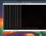
Software server MySQL DBMS operates in Windows environment, the process is controlled using commands entered from the console (Fig. 1). DBMS administration becomes more convenient when using software with graphical interface(Fig. 2), which can be downloaded for free from the MySQL website.
GIS database servers also include DBMS
PostgreSQL(http://www.postgresql.org). Like MySQL, this DBMS supports spatial data types (PostGIS extension) and is free.
GIS Software
Moving on to the consideration of software for GIS clients interacting with the above-mentioned DBMSs, we can offer two new and very promising programs: Viewport And KOSMO, which are currently available for download from the developer sites with the status “Beta” and “Release candidate”, respectively. The official release of the first version of these programs is planned in the next 2-3 months. cartoons
Viewport(developed by Texel corporation, http://www.viewportimaging.com/) multifunctional software for working with spatial data, supporting 37 file formats (ESRI Shape, MapInfo Vector File, ARC/INFO ASCII Grid, USGS DEM, EOSAT Fast Format, ERDAS Imagine, GIF, JPEG, TIFF, etc.) and 9 data sources (ArcSDE, Informix Datablade, MySQL, PostgreSQL, Oracle Spatial, ODBC RDBMS, Web Mapping Service, etc.).
A simple and convenient interface, a choice of map projection, the ability to create SQL queries and then display their results on the map, a lot of changeable parameters of graphic objects (changeable transparency, many types of hatching/filling, specifying the thickness and type of line, etc.), export to various formats all this makes the program very attractive for use.
 Rice. 3. Viewport screen copy |
The cost of one license is $99.95, but it is possible that licenses will be provided free of charge for non-profit institutions. Currently, you can download a free, but with a number of limitations, beta version of the program from the developer’s website.
KOSMO(developed by SAIG, http://www.saig.es/en) is a full-fledged GIS, provided completely free of charge. This program is the result of combining SAIG’s own developments and a number of open source projects (JUMP, JTS, GeoTools, etc.).
KOSMO allows you to connect to geoinformation databases (Oracle Spatial, MySQL, PostgreSQL-PostGIS), has large set tools for working with vector data, supports the most common raster data formats (TIFF, GeoTIFF, ECW, MrSid, etc.), has a good style editor and query builder, has the ability to expand functionality by connecting additional modules, and all this is just a small part program capabilities.
 Rice. 4. Screen copy of KOSMO |
In addition, you can select the interface language. In addition to English, Spanish and Portuguese, Russian will soon be available as the author of this article is currently working on translating the program interface into Russian.
GIS KOSMO is developed in the Java environment, so it is recommended to download the distribution kit, which already includes the JRE and JAI modules.
In a situation where you do not need to develop a complex GIS, but only need to display existing cartographic data, we can recommend free GIS viewers: Christine GIS Viewer (
ArcGIS -- family software products American company ESRI, one of the leaders in the global market of geographic information systems. ArcGIS is built on the basis of COM, .NET, Java, XML, SOAP technologies. Latest version-- ArcGIS 10.
Fig.3.1
ArcGIS allows you to visualize (present in the form of a digital map) large volumes of geographically referenced statistical information. Maps of all scales are created and edited in the environment: from land plans to a world map.
Also, ArcGIS has built-in wide tools for analyzing spatial information.
ArcGis is used in a variety of areas:
- · Land cadastre, land management
- · Real estate accounting (see: AIS for real estate accounting, ISOGD)
- · Engineering Communication
- · Ministry of Internal Affairs and Ministry of Emergency Situations
- Telecommunications
- · Oil and gas
- Ecology
- · State Border Service
- · Transport
- Forestry
- · Water resources
- Remote sensing
- Geology and subsoil use
- · Geodesy, cartography, geography
- · Business
- · Trade and services
- · Agriculture
- · Education
- · Tourism
This software is used for all types of computers: desktop (ArcView, ArcEditor, ArcInfo), server (ArcGIS Server, ArcSDE) and pocket (ArcPad).
Intergraph GeoMedia
GeoMedia is a GIS technology from the family of GIS products.
GeoMedia technology is a new generation GIS architecture that allows you to work directly without import/export simultaneously with a variety of spatial data in various formats. This is achieved by using special data access components - Intergraph GeoMedia Data Server.

Fig.3.2
Today, GeoMedia users have access to components for all major industrial formats for storing digital map data: ArcInfo, ArcView, ASCII, AutoCAD, FRAMME, GeoMedia, GML, MapInfo, MGE, MicroStation, Oracle Spatial, etc., including raster, tabular and multimedia data . However, users can develop their own GeoMedia Data Server based on a custom format template. Intergraph GeoMedia Data Server components allow you to view and simultaneously analyze data from an arbitrary number of sources, stored in different formats, coordinate systems, and with varying accuracy, on one map.
This approach allows you to maintain investments in existing GIS solutions, while at the same time switching to new level integration information resources enterprises. The GeoMedia product family includes two basic product lines - desktop and server - plus additional application modules.
GeoMedia is the prototype of the first version of international standards in the field of GIS, developed by the Open GIS Consortium and, at the same time, is the first implementation of these standards.
Intergraph GeoMedia is a software tool for obtaining, displaying and analyzing geographic data from various information systems. Used at remote client sites as a universal means of accessing traditional GIS such as MGE and FRAMME.
GeoMedia is both desktop system and a tool for developing your own specialized applications. In addition, GeoMedia has built-in map layout capabilities that are not available in other existing GIS.
Main functions:
- · Full access to data from GIS projects MGE, FRAMME (Intergraph), ESRI (ARC/Info), ESRI (ARC/View), MapInfo, Bentley/MicroStation and AutoCAD files.
- · Spatial analysis
- · Full integration of geographic data from various GIS
- · Customization according to user requirements
- · Coordinate transformations
- · Display raster files, support various formats
- · Construction of buffer zones
- · Construction of thematic maps, symbolization, placement of labels.
- · Working with Oracle SDO.
Software geographic information systems
1. General characteristics
GIS software tools are a set of more or less integrated software modules that provide the implementation of the basic GIS functions. In general, six basic modules can be distinguished:
1) data entry and verification,
2) storage and manipulation of data,
3) transformation of coordinate systems and transformation of map projections,
4) analysis and modeling,
5) output and presentation of data,
6) user interaction.
Given the wide range and very specific features of the functions implemented, geographic information systems software currently forms part of the global software market. There are a fairly large number of commercial GIS software packages that allow the development of geographic information systems with specific functionality for specific territories. The number of such GIS packages amounts to many dozens. However, if we talk about the most well-known and widely used commercial GIS packages, their number may be limited to ten to fifteen.
According to the results of research by PC GIS Company Datatech (USA), which analyzes the global GIS market, the first place in the ranking of GIS software products in recent years has been occupied by the MAPINFO package, developed by Mapping Information Systems Corporation (USA) and having about 150,000 users around the world. The most popular also include the ARC/INFO GIS package, developed by the California Environmental Research Institute (ESRI), and the IDRISI geographic analysis and image processing package, created at Clark University (USA). ATLAS*GIS packages from Strategic Mapping Inc. are widely known. (USA) MGE from INTERGRAPH (USA), SPANS MAP/SPANS GIS Firms Tydac Technologies Corp. (USA), ILWIS, developed at the International Institute of Aerial Photography and Geosciences (Netherlands) SMALLWORLD GIS from Smallworld Mapping Inc. (UK) SYSTEM 9 from Prime Computer-Wild Leitz (USA), SICAD from Siemens Nixdorf (Germany). It seems necessary to also mention the GIS package GEOGRAPH/GEODRAW, developed at the Center for Geoinformation Research of the Institute of Geography of the Russian Academy of Sciences, which, based on the results of research conducted in 1994 in Russia, took third place in the ranking of GIS software products, as well as WINGIS of the Austrian company PROGIS, which took fifth position in this ranking. Of undoubted interest for environmental research is the GIS package PC-RASTER, developed at the Faculty of Geography of the University of Utrecht (Netherlands) and having advanced analytical capabilities.
2. GIS user interface
Depending on the type and purpose of the GIS, the control environment (user interface) usually has several levels. GIS produces "information products" - lists, maps - which are later used for decision making by various categories of users. The end user may not interact directly with the system in most cases. For example, a municipal reporting system produces inventory lists that are used by committees to make decisions regarding various business activities. Committee leaders do not know anything about the organization of the municipal system, having only a conceptual understanding of what information is in the GIS and its functional capabilities. However, the system manager must have a detailed understanding of what information is in the database and what functions the GIS can perform. The systems analyst or programmer must have an even more detailed understanding of the functional capabilities of a particular GIS application. The end user usually interacts with the system through a special operator who provides information on both standard and individual requests.
The degree of complexity of communication between the user and the GIS is determined primarily by the degree of elaboration of the database structure, the correct identification of objects in the database and the presence of cross-references between different groups of objects. Obtaining any information from a database is carried out in most cases using special queries generated explicitly and implicitly. Implicit queries are usually already implemented in software and embedded in various functional blocks of the system by the software manufacturer. For example, clicking with the mouse cursor on a spatial object displayed on the screen initiates a “location-based” search algorithm for attribute information associated with this object. An explicit query is written by the user (GIS system programmer) using a special programming language (usually SQL, sometimes a language specially developed for a given system) in text editor, but have recently become widespread dialog boxes forming requests. Such queries can be saved in a special library and launched as needed.
Queries can vary significantly in their purpose and the algorithms performed during their implementation. A simple data request is made with specific object identifiers or precise locations and is often accompanied by an indication
Specific values of clarifying parameters. Other queries search for objects that satisfy more complex requirements. There are several various types search queries:
1. "Where is object X?" Here both the exact attribute characteristics of the desired object and a certain range of these characteristics can be specified. In some cases, the search radius and sector relative to the central point, sometimes a buffer zone of another object, can be specified.
2. "What is this object?" An object is identified ("selected") using a dialog device - a mouse or cursor. The system returns object attributes, such as street address, owner name, oil well productivity, altitude and
3. “Summarize the features of objects within distance X or inside/outside a certain zone.” Combining the two previous queries and statistical operations. "Which is the best route?" Determination of the optimal route according to various criteria (minimum cost, minimum extraneous impact, maximum speed) between these two or more points.
5. Using relationships between objects, such as finding underlying features or determining slope for digital elevation models.
For most GIS applications, the system must operate in real time: the maximum time allowed for a response is a few seconds. With sufficiently frequent calls to the system, purely ergonomic requirements for the user interface come first - menus and icons should be preferred to text commands, which are tedious to type. There are several types of user interfaces:
1. Team, which the user types on the command line, for example, C >. The user must follow the system-defined command syntax using precise notation and punctuation rules. However, in some GIS there can be more than 1000 such commands, which is very inconvenient for inexperienced users. Online help can reduce the need to know all the rules and syntax, especially for rarely used commands.
2. Menu. The user selects a menu item responsible for performing a specific function. A menu item represents a choice that is the only one available at that time. The consequences of the choice can be displayed in a special list next to each item. However, complex menu systems are tedious to use repeatedly and do not provide flexible commands.
3. Pictographic menus. This form of menu uses symbolic images to make the meaning of commands accessible and simplify operation. The user controls the system using icons for the most common functions and a regular menu for the rest. Many users understand symbolic systems better and learn GIS faster.
4. Window. The GIS interface should take advantage of the nature of spatial data. There are two natural ways to access spatial data - through spatial objects and through their features. Modern complex systems use multiple screen windows to display text and graphics data separately. Windows allow you to simultaneously display several views of the same map, for example, in full coverage and in an enlarged image.
5. National interface language. The obvious benefits of using the national language in menu systems and online help are immediate. Both the speed of mastering the system and the completeness of using its functionality increase sharply. Most GIS software manufacturers are currently promoting “adapted” versions of their products to foreign national markets (the standard is English).
Many GIS shells combine several approaches to organizing the system management environment, creating a combined interface with both a regular “drop-down” menu and a set of pictographic menu blocks. Sometimes it is additionally used command line, and many commands are recognized by their abbreviated form (the first two or three characters).
Development hardware determines the development of other types of interface. Touch displays will allow the user to select an object or issue commands by simply touching a specific area of the screen with a finger or a special pointer. For some types of applied GIS, working with large-scale terrain models, it is possible to introduce technologies " virtual reality" when modeling the earth's surface and spatial objects located on it: buildings, trees, etc.
GIS software - 4.5 out of 5 based on 2 votes